




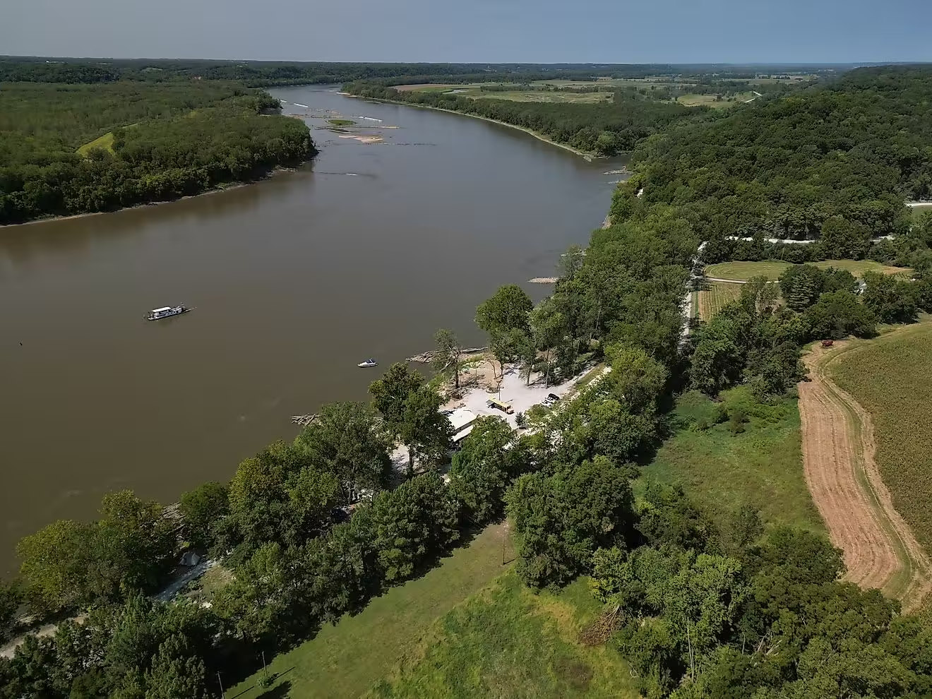

The Missouri River earned its nickname, the Big Muddy, by carrying enormous quantities of sediment across the American interior. Its brown water connects the Rocky Mountain headwaters of Montana with the Mississippi River near St. Louis, a journey of approximately 2,341 miles. Along the way, sediment helps build sandbars, reshape riverbanks, and sustain floodplain habitats. The Missouri also has a long history as a major supplier of the material carried downstream by the Mississippi. These characteristics make it a contender for muddiest river in the United States. Other rivers, like New Mexico’s Rio Puerco, can also carry exceptionally concentrated sediment.
Why the Missouri River Is Called the Big Muddy
The Missouri River’s nickname reflects the sediment that historically filled its channels. Before extensive engineering changed the river, erosion and deposition continually rearranged its banks, islands, sandbars, and side channels. Water carried material away from one place and deposited it somewhere else, creating a river corridor that shifted across its floodplain. The National Park Service specifically connects these high sediment loads with the name “Big Muddy.”
That reputation also has a measurable foundation. A US Geological Survey assessment of the Mississippi River Basin found that the Missouri carried the largest annual suspended-sediment load among the Mississippi’s major subbasins. Sediment transport in the lower Mississippi was most closely associated with contributions from the Missouri.
That makes the Big Muddy more than a colorful nickname: It describes a river whose sediment has influenced waterways far beyond its own mouth. However, the Missouri is so long and so varied that not every stretch of it is muddier than every other river in the country.
What “Muddiest River” Actually Means
Naming America’s muddiest river is more complicated than comparing shades of brown. Scientists can measure it using three factors: suspended sediment, sediment load, and turbidity. Suspended-sediment concentration measures how much sediment a volume of water contains.
Sediment load measures the quantity transported by the river over time. Turbidity describes a visual property, or how particles affect the passage of light through water.
A large river can move an enormous sediment load without having the highest concentration. A smaller stream can carry far less water yet become extraordinarily sediment-rich during a flood. These differences matter when comparing the Missouri with rivers such as New Mexico’s Rio Puerco. The Missouri is a historically important sediment carrier but not an uncontested record holder for all three factors.
From Montana to the Mississippi
The Missouri River’s headwaters come together in the Three Forks area of southwestern Montana, where the JeffersonMadison, and Gallatin rivers converge at Missouri Headwaters State Park. From this mountain setting, the Missouri follows a roughly 2,341-mile course to its meeting with the Mississippi near St. Louis. Its drainage basin covers approximately 529,350 square miles, gathering water and sediment from a substantial portion of the American interior.
The landscapes within that basin help explain the river’s history with sediment. Northern areas contain glacial deposits, while other regions include eroded valleys, broad Great Plains river corridors, and rolling uplands. These are parts of the landscape through which water travels before reaching the main river.
Farther downstream, the Missouri National Recreational River stretches along Nebraska and South Dakota. This 59-mile section has a broad floodplain of sandy material that has been deposited into the river since the last ice age, a reminder that the river has been transporting and rearranging sediment for far longer than its nickname has existed.
What Makes the Missouri River Muddy

The Missouri’s muddy appearance comes from sediment carried by moving water. Some particles travel suspended within the flow, while other material rolls or moves along the riverbed as bedload.
Sediment can also settle onto the bottom or accumulate along banks. These processes can change the river’s appearance as it goes: carrying material, eroding channels, and building deposits downstream. Sediment is a natural part of river systems and helps support their ecological functions.
Tributaries add to the sediment load even more. In North Dakota, a United States Geographical Survey (USGS) study of major tributaries between Garrison Dam and Lake Oahe found that the Heart River contributed the greatest suspended-sediment load among the tributaries examined. The Knife River ranked second. Such findings show why the Missouri’s sediment cannot be traced to one source or one stretch of riverbank.
High flows can move unusually large quantities, too. During the Missouri’s 2011 flooding, suspended sediment accounted for about 93 percent of measured total sediment load at the study sites, except at one site where it was 72 percent. Most of the measured material was traveling within the water rather than along the bed.
How Dams Changed the Big Muddy

The Missouri River doesn’t transport as much sediment as it did before large-scale river engineering. Dams trap material in reservoirswhile bank stabilization and other channel modifications restrict sediment sources that once fed the current. The National Park Service describes substantial changes to the Missouri’s flow and sediment movement following development for flood control, irrigation, hydropowerand other uses. The Big Muddy’s present appearance is not as concentrated as it was historically.
These effects extend downstream, too. A USGS assessment estimated that the combined Missouri-Mississippi system transported an estimated 400 million metric tons of sediment every year to coastal Louisiana before 1900. Between 1987 to 2006, the average was lower at approximately 145 million metric tons annually. The combined river systems have both seen drops in their sediment load over time.
Conditions also vary from reach to reach. Research comparing the Missouri’s 2011 flood with more typical flows in 2012 found much lower sediment loads during the latter period. This means that prolonged flooding could temporarily deplete local sediment supplies. Even in the Big Muddy, the amount of available sediment changes.
Sandbars and the Missouri National Recreational River
Mud and sand are not just material passing through the Missouri; they help create the river’s habitats. Before extensive development, erosion and deposition maintained braided channels, sandbars, backwaters, and other environments across the floodplain. These changes made the river corridor ecologically varied. A shifting bank or newly deposited bar was part of the river’s natural operation.
The Missouri National Recreational River’s two river reaches have experienced substantial changes in flow and sediment conditions, despite comparatively limited channel engineering within those reaches themselves. That contrast means that a river segment doesn’t always change in response to dams and other changes. It can retain much of its physical character despite development in its watershed.
Honorable Mention: New Mexico’s Rio Puerco
New Mexico’s Rio Puerco is also a strong contender because its sediment concentrations can be extraordinary at times. Its concentrations regularly range from 10,000 to 200,000 milligrams per liter, with recorded values exceeding 500,000 milligrams per liter.
Research near Bernardo, New Mexico, also shows how sediment transport interacts with an arroyo landscape. Water can infiltrate the streambed and floodplain as it moves downstream, encouraging sediment deposition.
Over time, declining peak flows, water losses along the channel, and the development of an inner floodplain have helped increase deposition and reduce sediment loads in downstream reaches. The Missouri still holds the Big Muddy title, but Rio Puerco’s sediment concentration and total sediment load are also impressive.
Source: www.worldatlas.com